Informal Urban Mobility Mapping
A Comparative Study of Maré, Nairobi, and Jakarta
This project explores how informal transportation systems adapt to pressures from governance, security, and infrastructure challenges. Using open spatial data, semi-structured interviews, and field observations, I analyze informal transit practices in Maré (Rio de Janeiro), Nairobi, and Jakarta. A mixed-methods approach pairs statistical regressions with qualitative comparative analysis to reveal the core adaptations enabling resilience across these three cities.
Urban transport networks often fail at the urban fringe. Informal operators fill these gaps but are typically treated as anomalies. This project reframes them as resilient systems with structured adaptive strategies.
Research Question
How do informal transit systems in Maré, Nairobi, and Jakarta adapt to governance, security, and infrastructure pressures, and what shared patterns support their resilience?
Why Informal Transport Remains Unmapped
Despite handling billions of trips, informal networks are often missing from transport databases:
Traditional surveys undercount informal mobility by 300-400%.
Multi-leg journeys (e.g., 2.8 transfers per commute in Kampala) are hard to track.
This data gap leads to poor investment decisions, like Nairobi’s 2019 BRT project, which displaced 40,000 matatu workers due to a lack of employment data.
OpenStreetMap-based initiatives like the Million Neighborhoods Map help fill this gap, achieving 89% accuracy in mobility mapping.
Open Data Solutions
Digital Matatus (Nairobi) – Mapped 137 routes, revealing 4.2x denser transit than official maps.
GTFS-Flex – Supports variable stops and demand-based routing, successfully mapped 94% of Manila’s jeepney routes.
Deep learning on satellite imagery - A model trained on Sentinel-2 identified informal hubs in Dar es Salaam with 82% accuracy.
Graph neural networks (GNNs) -Predicted Bogotá’s fuel-protest-induced network adaptations with 89% accuracy.
Complexo da Maré
Adaptive Routing Under Fire
In Rio’s Maré favelas, kombi vans sustain daily mobility despite persistent violence.
Real-time detours through alley networks allow drivers to bypass police raids and gang conflicts, guided by WhatsApp spotter chains.
Even during high-pressure months, 91% of routes maintained partial service by dynamically adjusting paths, without official coordination.
Nairobi CBD
Negotiating Governance
In Nairobi, matatus adapt to evolving governance pressures like CBD entry bans and traffic fines.
Operators selectively comply by forming SACCOs and pre-paying negotiated access fees, enabling flexible staging points across peripheries.
Despite formalization attempts, informal actors preserved 84% of original matatu routes with slight detour shifts and creative drop-off points.

What Defines Informal Transit?

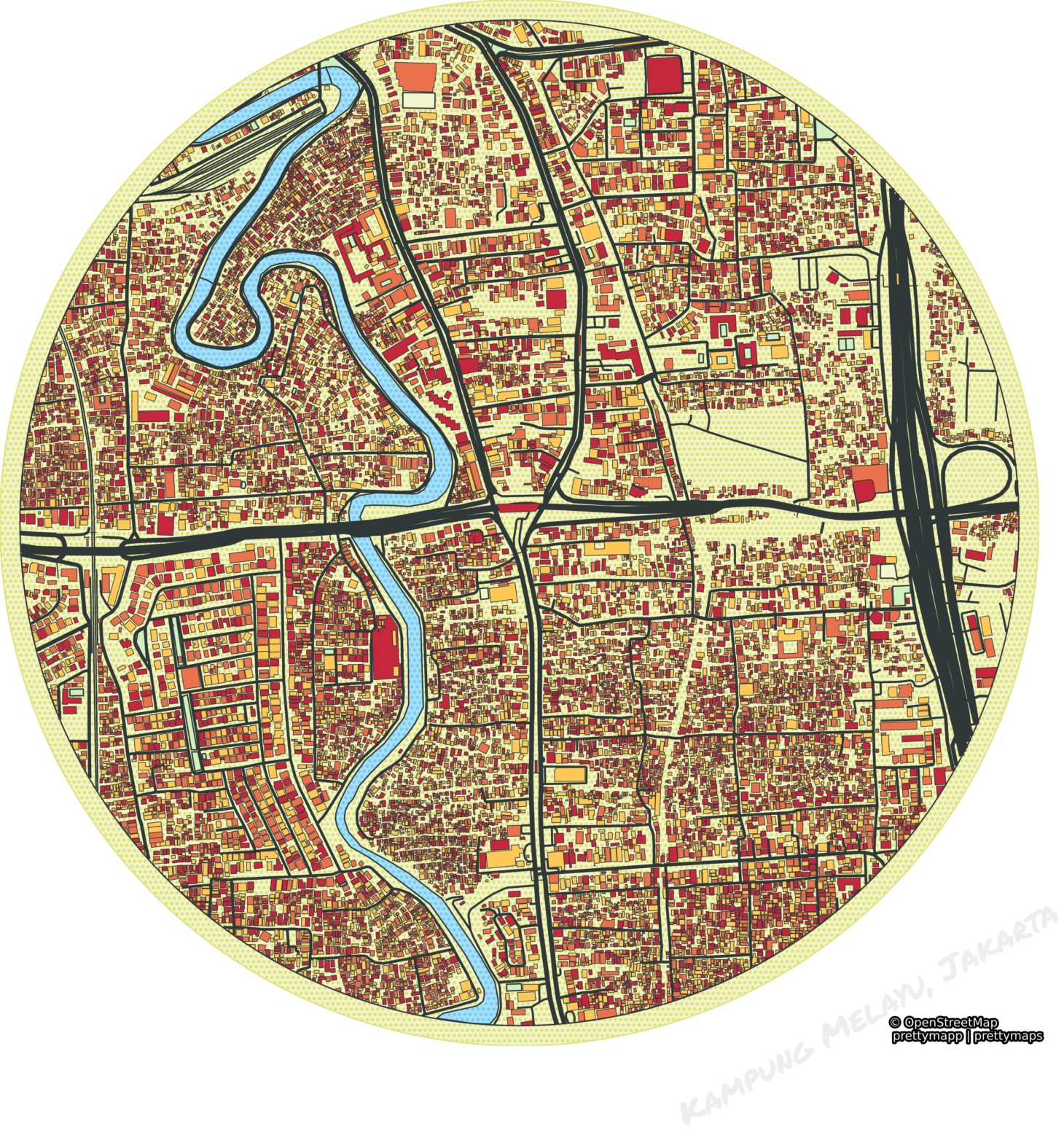
Kampung Melayu
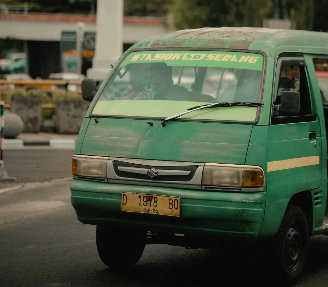
Flood Resilience in Jakarta
Jakarta’s angkot minibuses face recurrent monsoon flooding, with water regularly cutting off main corridors.
Operators adapt by elevating routes onto rail embankments and flyovers during floods, maintaining affordable service for underserved neighborhoods.
Temporary fare surcharges and decentralized reroutes sustain operations even during 1-in-5-year flood events.

Dynamic routes – Adapt to demand rather than fixed schedules.
Decentralized ownership – Run by small entrepreneurs.
Flexible payments – Integrated with local economic practices.
For example, in Dar es Salaam, daladala minibuses adjust their routes in real time based on passenger density, creating an intricate transport web that formal buses cannot navigate.
Policy Recommendations
Drawing from observed adaptation strategies, the following policy actions can enhance the resilience of informal transit systems without undermining their flexibility:
Publish real-time disruption feeds
Cities should develop public data feeds that communicate incidents such as shootings, traffic jams, or flood alerts, allowing operators to adjust routes early and safely.Create micro-insurance programs
Micro-insurance schemes can offer compensation for income lost during periods of insecurity or infrastructure disruption, providing financial security without imposing rigid formalization.Integrate informal networks into trip planners
Including informal transit data within public trip planning apps can increase transport visibility and reliability, enabling passengers to navigate mixed mobility ecosystems more effectively.Design flood-resilient or elevated corridors
Investing in a small number of elevated or flood-resilient pathways along key routes offers reliable bypass options during disruption events, benefiting both informal and formal operators.
“The right to the city is far more than the individual liberty to access urban resources: it is a right to change ourselves by changing the city.”
These findings suggest that rigid corridor-based planning models risk weakening the natural resilience of informal systems. Rather than attempting to formalize routing patterns completely, transport planners should focus on legalizing flexible routing frameworks that preserve operators' capacity to self-adjust in response to dynamic urban conditions.
Cities that merge formal and informal mobility data achieve 23% higher transport equity scores. New protocols like Mobility Data Specification 2.0 now accommodate informal transit patterns.
To build resilient urban transit, we must embrace technology-driven, community-led solutions that recognize the power of informal mobility networks.
Integration
Inclusive Transport Planning
Cape Town – Integrated taxi ranks at BRT stations, reducing duplicate routes by 22% and improving commutes by 18%.
Bogotá – Digital Twin model mapped 17,000 informal buses, leading to new bike lanes in high-density corridors (+14% cycling share).
Data Governance Models
Nairobi Mobility Data Trust – Informal operators own their data while contributing anonymized insights. Led to a 37% increase in night services and 62% faster emergency responses.
Malaysia’s MyGDX – Integrated informal transit with census data, directing RM 480M to underserved areas.